| Cover | Global Links | Solar System | Deep Space | Rockets |
| Satellites | Space Shuttles | Space Stations | Astronauts & Cosmonauts |
Satellites Watch Rain Forests Disappear
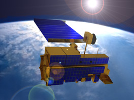
A 21st Century Satellite Orbiting Earth
Tropical rain forests cover less than seven percent of Earth's surface, but are home to more than half of all plant and animal species.
Biodiversity, the range of life, has become a major environmental concern. Many tropical plants and animals produce chemicals useful in medicine and other industries.
Trees hold more carbon than crops. Converting forests for pasture and cropland releases carbon dioxide into the atmosphere, contributing to the "greenhouse effect" in which carbon dioxide and other gases in the atmosphere trap heat radiating from Earth, as glass traps heat in a greenhouse.
More than 64,000 square miles of tropical forest are destroyed around the world each year, leading to extinction of large numbers of plants and trees.
In South America, for instance, there has been major deforestation of Brazil's Amazon River basin, the largest continuous tropical forest region in the world. The basin covers two million square miles in eight states, including 1.6 million forested acres, 330,000 tropical-savanna acres and 35,000 acres of water. More than 6,000 square miles of the basin are deforested each year.
Checking the extent of deforestation in 1993, NASA examined 200 photos from the satellites LANDSAT-4 and LANDSAT-5, covering the entire forested portion of Brazil's Amazon Basin. The images confirmed the bad news -- agricultural expansion has been deforesting the area rapidly for two decades.
"Edge effects" of wind, weather, foraging livestock, non-forest animals and humans are threatening the habitat of plants and animals living on the fringes of remaining forests fragments.
NASA helps Belize, Costa Rica, El Salvador, Guatemala, Honduras, Nicaragua and Panama protect the ecology of their rain forests by training technicians to use satellite data to measure Central American vegetation and forest cover and monitor endangered plant and animal habitats.
For instance, Guatemala uses information from satellites to supervise 14,000 square miles of forest and savannah in a northeastern reserve.
SatBytes index Satellites main page Space Today Online cover E-mail Copyright 2001 by Space Today Online